
Cortes Currents published a factually incorrect story about the proposed Anvil Lake logging road on Tuesday, August 30, 2022.
Few people knew this, because I pulled the story before it was broadcast on Cortes Radio.
Nick Reed, a local resident, told me, “The concern is mainly the wetlands that this road has to go through, and what effect that will have on Gunflint (and Anvil) Lakes. It is the last wetland on the southern part of Cortes.”
Mark Lombard, general manager of the Cortes Forestry General Partnership (CFGP), responded, “The CFGP never builds roads through wetlands.”
Prior to that, he emailed, “There are small, medium, and large wetlands throughout the forests of Cortes. The CFGP is not building roads through any of them.”
That’s when I pulled the story.
The project map on the CFGP website supports Lombard’s statement that they are not crossing a wetland. The proposed logging road runs alongside a small ‘wet area’ for about 30 metres, but does not cross it. There is a much larger ‘wetland’ hundreds of metres to the east. The proposed logging does not cross either of them.
Lombard explained, “The community forest doesn’t have a mandate for profit, like most big forestry companies. A lot of the crown land in BC is logged by BCTS (BC Timber Sales), which is also trying to maximize profit through timber sales. But the community forest has a conservation mandate. We have a goal to age the forest. So we’re logging quite a bit less than what we’re mandated to log, something like 15% in the first eight years of holding the license. We don’t have to operate really close to lakes or riparian areas or wetlands.”

I would have been aware of this had I attended the public meetings or gone on one of the walkthroughs for this project, but I originally did not intend to report on it. My involvement began after Reed phoned to air his concerns, and I suggested it would be better if he showed me.
We met on August 21, then Reed led me into what turned out to be the wrong wetland. The map for this project shows the ‘wet area’ beside their proposed logging road starts about 125 metres from Gorge Harbour Road, but we entered a large ‘wetland’ immediately upon leaving the road. The only ‘wetland’ corresponding to this description on the map was hundreds of metres to the east.
While the surface was dry, this wetland had obviously been covered by water not long before. After awhile that dry surface softened and I found it turned to mud if you scuff your feet. We floundered about, climbing over fallen logs and through the brush, looking for CFGP’s ribbon line. Reed apologized for the confusion, explaining he had only visited the wetland a few times before. We eventually found a ribbon line on the far edge of the wetland.
This would have been irrelevant as we were not in the correct area, except it was part of a false impression forming in my mind. When I contacted the CFGP board later that day, I informed them Reed had shown me their project area.
They asked that I defer publishing anything until they release a response to neighbourhood concerns, which occured on August 28.
Lombard would later explain there are a lot of ribbons that have nothing to do with CFGP in the forest. He also said they do not build roads through wetlands, and a fish bearing creek flows out from that large wetland and into GunFlint Lake. That was the type of area the community forest would really try to avoid.

I believe Reed and I encountered the correct ‘wet area’ on our return from Anvil Lake. Ironically, Reed said it was the spot that most clearly matched his memories from the recent CFGP walkthrough. He pointed to where the proposed road would run along the side of the wet area and how the land sloped upwards beyond that.
“The runoff across their road or underneath their road, depending on how many culverts they put in, will flood this wetland. It will change it in many ways,” he said.
Lombard explained that the CFGP chose this site for a logging road after two years of careful research.
“The road has nothing to do with individual blocks. It’s not based on individual harvest plans for this year, or in 10 years, or in 20 years, it’s simply the best place to access the entire area from. It is an investment, not part of a logging project where the logging has to pay for the whole road. It’s not at all like that,” he said.
There are three possible routes to the bluff. There is an old skid road, but it is too steep and ‘could never be ditched properly.’ The second choice would require a bridge from the public road. They picked the spot where the road would have the least ecological impact.
“Where we’re crossing the wet area … is at the high end of it, the top end of the system where it hasn’t become a wetland yet. It’s a wet area, but it’s bounded on two sides by Thunder Road and the public road (Gorge Road). There are culverts that drain the top area, so there’s not very much water.”

Reed said the Anvil Lake area is a wildlife corridor and some species at risk have been sighted.
“Let’s hold off for a minute and do an impact study, or at least do an ecological survey, which I think by law, is something that the community forest should do”
Lombard responded, “It has been done, to a certain extent. We’ve consulted with the Regional Biologist. Our Forester has been in there twice and she’s contacted the Regional Biologist. She’s also talked with a spotted owl expert because there was some suggestion that someone may have heard a spotted owl and avenues have been extensively researched. We’ve done our due diligence. I don’t think that we have any further need for an ecological survey in the area where road is going.”
In a letter the CFGP emailed to the neighbourhood, they state the Regional Biologist is not recommending any further assessment at this time.
Reed also expressed concern about the impact this proposed road will have on the wells around Anvil Lake.
The CFGP wrote that they are “committed to the stewardship of drinking water and does not expect that any of the activities under consideration will impact residents’ drinking water. If anyone has specific concerns about their drinking water source as it relates to the proposed road work, please contact the CFGP.”

Ian King, who also lives at Anvil Lake, informed Cortes Currents he’s concerned about the increase of traffic that a road would bring. He mentioned strangers already wandering through his yard on the way to the lake. A winnebago once attempted to access it via King’s driveway.
“We’ve got enormous issues with the cut block above us, particularly above the highway shed. There’s a lot of target practice going on up there, with rifles. One Sunday, at four o’clock, rifles went off for over an hour. The neighbor counted over a hundred gunshots, and we’re talking in the midst of a fire ban here too,” he said.
Reed added, “We seem to be clearing up more and more garbage around the lake.”
King said, “We’re on a remote island. It is a beautiful lake, but I think if any access is going to go there, it has to be done responsibly, tastefully, and in line with how the rest of our lakes are used and accessed.”
The CFGP promise to install a gate at the entrance to their road.
Reed scoffed at this, “If you put a gate there, people will go by it and they will come in.”
(Editor’s comment: The gate will most likely stop most visitors, the question should be how many will go past it and will they make an impact on the area?)
Lombard said, “The closest point the road comes to anybody’s house is probably 280 meters. and there’s lots of vegetation and forest in between. It’s not coming close to the neighbors and there’s going to be very little activity in there over the years. So I believe the impact of the neighbors will be very minimal.”

The CFGP decided to commence road building operations this Fall.
Their letter states,” Harvesting could start as soon as next Spring, but will depend on multiple factors including market conditions, local demand for logs, and access in other areas of the community forest.”
Lombard said they will leave a big buffer (‘about 200 metres’), between the cutting area and Anvil Lake. He does not expect much of an impact on wildlife or biodiversity. They are thinking of thinning a few one to two hectare blocks, and not touching the big trees.
“Throughout the forest land base on Cortes Community Forest, or otherwise, there are lots of individual ‘vets’ that they left back in the day when they did the first round of logging,” he explained. “The Community Forest always leaves those … and we’ve made the road so that it doesn’t go close to them either.”

The Anvil Lake area is dominated by 70 to 80 year old hemlock, which have not been doing well in our biogeoclimatic zone.
“After 80 years, it typically becomes decadent and falls over, or breaks off. So what we’re trying to do is gradually harvest some of that Hemlock while it still has value. Then convert that area gradually by planting other species, like fir and alder that are going to have other benefits, so that we have a little bit of a mosaic or a tapestry of different age classes and species in that area,” said Lombard.
“One of the things we’re trying to do is rehab forestry, where we go after the diseased species or the diseased forests, and try to convert those to healthier forests.”
This also has a wildfire mitigation component, which the community forest has been working on for several years.
Lombard stressed the idea CFGP is not highgrading, or concentrating their activities in one area where there is roads or infrastructure.
“We’re trying to leave a better forest for the next generation.”
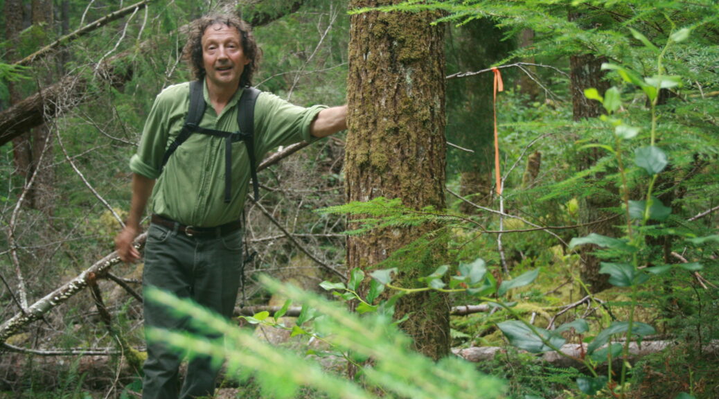
Top photo credit: Nick Reed – Photo by Roy L Hales
Sign-up for Cortes Currents email-out:
To receive an emailed catalogue of articles on Cortes Currents, send a (blank) email to subscribe to your desired frequency:
- Daily, (articles posted during the last 24 hours) – [email protected]
- Weekly Digest cortescurrents – [email protected]