

Across the Strait of Juan de Fuca from Victoria, a brownish haze clings to the Olympic Peninsula’s shore. There are reports of ash raining from the sky in Vancouver, Salt Spring Island and Nanaimo. The sun was a reddish-brown color in Qualicum Beach. There are severe wildfires along the West Coast, from Alaska to California. There may be more than drought behind the fires: Is this Climate Change?
Hotter & Drier Conditions

“Climate change is producing hotter, drier conditions in the American West, which contribute to more large wildfires and longer wildfire seasons,” a 2014 report from the Union of Concerned Scientists concludes.
Some of the statistics:
- “The western wildfire season has grown from five months, on average, in the 1970s to seven months today. The annual number of large wildfires has increased by more than 75 percent.
- “The expense of fighting wildfires and protecting life and property from harm is nearly four times greater than it was 30 years ago and has exceeded $1 billion every year since 2000 (in 2012 dollars).”
What was once called California’s drought now extends from Mexico to Alaska.
California’s Worst Fire Conditions Ever

After four years of drought, California is experiencing the worst fire conditions ever.
So far, this has not translated into fire damage, though statistics on the Cal Fire website show more fires than at any other period during the drought.
Yet, as Cal Fire Captain Kendall Bortisser told NBC news, “The danger is always there. We’re not getting the rains, the fuels are dry, they’re volatile.”
3 To 5 Weeks Earlier In Washington & Oregon

This is the second year of drought for Oregon, and it has now reached Washington state. Seattle, where the LA Times quips “the sun does not appear before July 5,” has just gone through the hottest June on record.
The National Interagency Fire Center identified Washington and Oregon as two of the three U.S. states where, “the majority of the wildfire activity remains …” Fire season started “three to five weeks ahead of schedule” in the Pacific Northwest and many believe this is going to be the pattern for years to come.
“This is a stress test for 2070. We’re being tested now with the warmth and lack of snowpack that will be typical at the end of the century. How do we get through it?” said Cliff Mass, a professor of atmospheric sciences at the University of Washington.
A New Record In Alaska

There is a new record in Alaska. The previous one was set in June 2004, when 216 fires consumed 1,153,257.9 acres. On June 29, the folks at Alaska Wildland Fire information posted that 399 fires had already burned some 1,600,000 acres in 2015.
“In the past 60 years, Alaska has warmed more than twice as fast as the rest of the country, with average temperatures up by nearly 3°F.” they wrote on Climate Central.
“Alaska’s wildfire season is about 40 percent longer now than it was in the 1950s. The first wildfires start earlier in the year, and the last wildfires are burning longer into the fall. Overall, the wildfire season has increased more than 35 days and is now more than three months long, running from May through early August.”
“Rising temperatures across Alaska have been concurrent with the rise in the number and size of Alaskan wildfires. Years with the hottest May to July temperatures also tend to be years with the most fires, and the greatest area burned.”
BC’s Fire Fighting Budget Already Spent
According to the Globe and Mail British Columbia has just gone through the warmest winter and spring since 1948. Sierra Club BC says there hasn’t been a Spring this dry since 1937, and there is no rain in sight. A Level 4 drought rating, the highest on the scale, is in effect for southern Vancouver Island and the Gulf Islands.
The province’s firefighting budget is already spent. This is not a problem of itself, because the province deliberately keeps the budget low to avoid trapping money that could be used elsewhere. Yet there are currently 184 active wildfires and 9 evacuation orders alters in effect. A provincial fire information officer told the Globe and Mail, “The fire activity we’ve been seeing and the fires of note, we usually see that in July-August, not May-June.”
Dr. Michael Brauer, professor in UBC’s School of Population and Public Health, said the fires are starting early this year. He hasn’t seen any quite as intense as yesterday, or early this morning, since Burns Bog was on fire a decade ago.
The East Coast Of Vancouver Island

Driving home from a family gathering in Victoria, I could not help but notice that the haze extends for hundreds of kilometers up the east coast of Vancouver Island, hiding the mainland from view. It grew stronger as we proceeded North.
There was a faint trace of smoke in the air at Heriot Bay, on Quadra Island. The stench became pervasive on Cortes Island, where it would otherwise be possible to mistake the incoming haze for fog.
There was a faint trace of smoke in the air at Heriot Bay, on Quadra Island.
The smell was much stronger by 4:30, when we returned to Cortes Island. A number of residents have confirmed that the smoke thickened around supper time. Two kayakers said they could no longer see across Squirrel Cove. There was an asthma attack in Squirrel cove.
BC’s Mainland
There were more across the water in Sechelt, where respiratory patients filled the Emergency Room at St. Mary’s Hospital overnight
All the respiratory patients had pre-existing health conditions such as asthma, but several were members of the local homeless population who were unable to go indoors to escape the smoke.
Dr Brauer explained yesterday in terms of two events. The Sechelt fire “looked pretty dramatic, but the air quality measurements at ground level were quite low. Then late in the afternoon, around 4:00, is when things got really bad. I haven’t confirmed this, but it sounds like that is from fires near Pemberton.”
Someone traveling from Victoria to the Lower Mainland said the smoke didn’t seem to get bad until they got onto the ferry. It was worse in the Greater Vancouver area. Several stores were selling face masks.
Forecasts

As of 5 am on Monday morning, July 6, 2015, Environment Canada predicts “widespread smoke” for the Lower Mainland, Greater Victoria, eastern Vancouver Island.
Later that morning, air quality advisories were “continued for Metro Vancouver, Greater Victoria as well as east and Inland Vancouver Island.”
The wind changed direction again this morning, and “appears to be clearing things out” of the Lower Mainland.
“There are fires in Washington state that may impact us if we keep having the wind come from this direction. Probably not today, but perhaps by tomorrow. Right now, the Lower Mainland is surrounded by fires on at least three sides, so even though this smoke might clear out we could get hit with some other smoke,” said Dr Brauer.
Is This Climate Change?

He does not believe you can “tie one event to Climate Change, we have evidence over the last twenty years, or so, that the climate has warmed and we are seeing fires start earlier and the fire season last longer.”
There have been 857 fires, which destroyed 149,000 acres so far this year.
The Vancouver Province overlooked the fact it is only the beginning of July and pointed out the devastation was far worse in 1958.
According to Sierra Club BC, “In the past five years, B.C. has had an average of 320 wildfires per year burning 12,744 hectares.”
“The negative effects of climate change—increased drought and forest fires, and threats to salmon and shellfish—will only increase as our planet warms. The very basics of life, such as clean water and food, will be increasingly imperiled, while major sectors of our economy and the jobs that go with them will be hurt,” said Sierra Club BC campaigns director Caitlyn Vernon.
Her organization suggests the province take bold actions to tackle climate change and factor a climate test into all future infrastructure decisions.
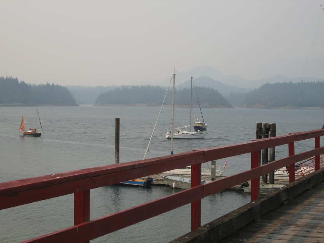
Top Photo Credit: The haze at Qualicum Beach, B.C., around 10:30 a.m. on July 5 – Roy L Hales photo
One thought on “The Fires – Is This Climate Change?”
Comments are closed.